TATW Map of the Months 2023
The Arctic Institute Map of the Month Initiative
Maps provide a useful means of understanding the various ways a region can be understood depending on the industry, discipline, culture or individual. Further, maps allow for the visualization of development and change in a region. Thus, the purpose of our TATW Map of the Month initiative is to highlight the various ways our changing Arctic can be visualised, by showcasing maps created by various geographers, cartographers and organisations around the world. Maps selected for each month reflect a relevant finding or event related to Arctic geography. TATW Map of the Month maps were not be created by The Arctic Institute, but rather shared with permission from the owners in order to make Arctic-related maps more accessible. Check out our 2023 TATW Maps of the Month below.
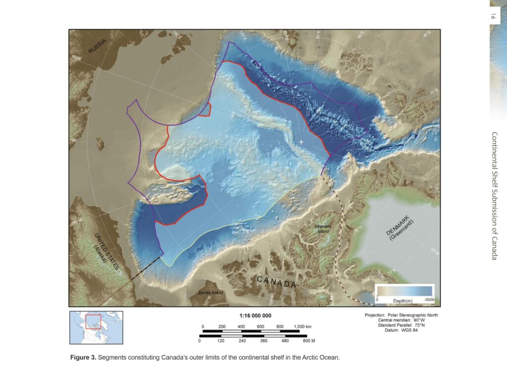
Canada’s outer limits of the continental shelf in the Arctic Ocean (Map of the Month January 2023)
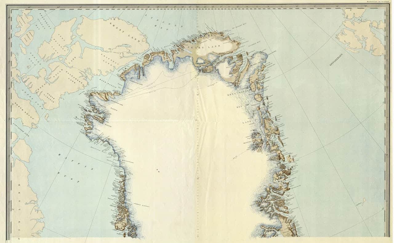
First official Danish map to show Peary Land as an integral part of Greenland and therefore of the Kingdom of Denmark (Map of the Month February 2023 – @ Royal Danish Library)
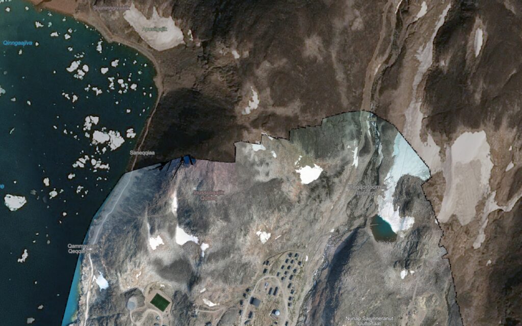
New satellite mapping project of Greenland (Map of the Month March 2023)
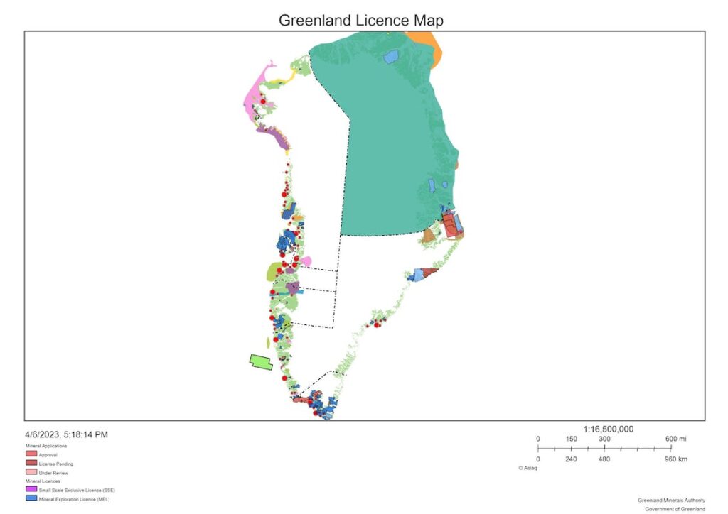
Greenland licence map 2023 (Map of the Month April 2023)
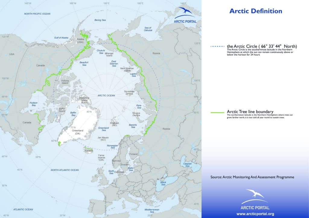
Arctic tree line boundary (as of 2016) (Map of the Month May 2023)
“Making the Arctic City – The History and Future of Urbanism in the Circumpolar North” by Peter Hemmersam (Map of the Month June 2023)
No Map of the Month for July 2023
Arctic Indigenous Peoples languages and revitalization Map 1.0 (Map of the Month August 2023)
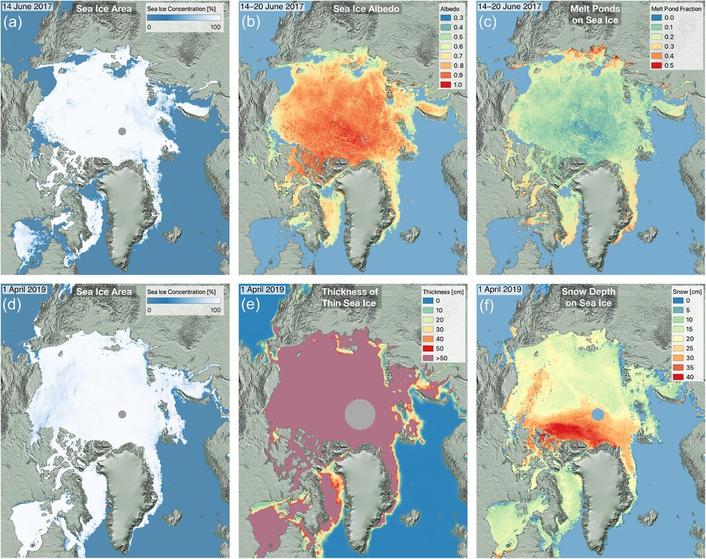
Arctic amplification phenomenon (Map of the Month September 2023)
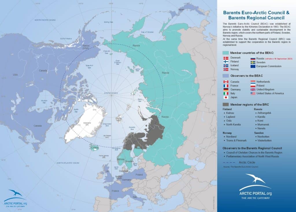
Map of the members of the Barents Euro-Arctic Council (Map of the Month October 2023)
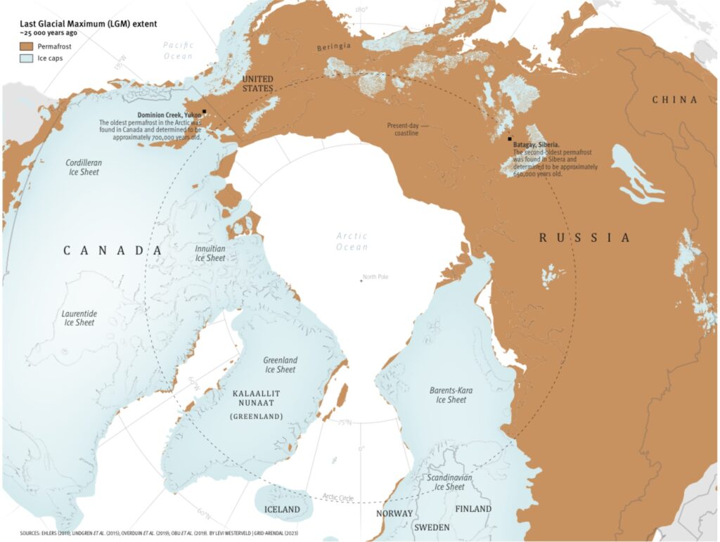
Last Glacial Maximum extent (Map of the Month November 2023)
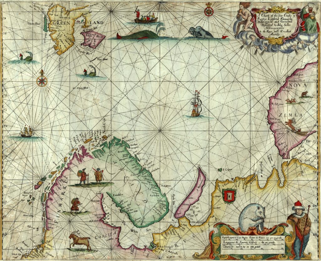
Chart of the sea coasts of Russia, Lapland, Finmarke, Nova Zemla and Greenland (Map of the Month December 2023)