Local Perspectives in Disaster Risk Reduction: Visualising Disaster Risk in Svalbard
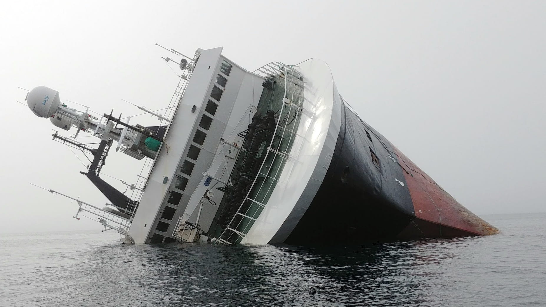
The grounded trawler “Northguider”. Photo: Dina Brode-Roger
The Arctic Institute Polar Disaster Series 2026
- The Arctic Institute’s 2026 Polar Disaster Risk Reduction and Response Series: An Introduction
- Crisis Management in Arctic Communities: Principles of Crisis Response
- Disaster Risk Reduction and Response: Greenland
- Risk Analysis of Infrastructure Vulnerability and Sustainable Resource Exploitation in the Arctic
- Ships in the Arctic Need to Plan to Survive Until Help Arrives
- From Pandemic to Permafrost: Legal Pathways for One Health Preparedness in Arctic Communities
- Icebergs and Navigation Safety in Antarctica: Possible Impact of new Sea-Ice Regime in the Southern Ocean and South Atlantic Ocean
- Legal Preparedness for One Health in Polar Regions: Strengthening Disease Surveillance
- A Framework for Avoiding Polar Disasters
- Keeping an Eye on Iceland: Volcanoes and Climate Change
- Choosing the Bear: Navigating Spectacular Risks in Longyearbyen
- Local Perspectives in Disaster Risk Reduction: Visualising Disaster Risk in Svalbard
- The Arctic Institute’s 2026 Polar Disaster Risk Reduction and Response Series: A Conclusion
In this photo essay, we present eight Disaster Risk Reduction and Response (DRR/R)-related photographs taken in Svalbard that reflect both the globally perceived and locally experienced risks in this high Arctic archipelago. These images, supported by disaster science background and local perspectives derived from years of in-depth ethnographic and interdisciplinary research, reveal differences between externally constructed risk narratives and lived, place-based understandings of vulnerability and resilience.
The structure of this photo essay is multiple: the first four images represent risks as seen from ‘elsewhere’—from the perspective of national, international, and academic discourses on Arctic security and climate risk. The second four represent some of the risks most commonly articulated by those who live and work in Svalbard year-round. In the case of the first four images, they are taken in a ‘view from elsewhere’ framing, making them more generic and potentially readable as coming from any Arctic setting. The second set of four are grounded in the specific setting of Svalbard. This difference is intentional and is meant to help reveal various framings and perspectives as portrayed in the visual as well as in the narrative discourse. For each image, there are two short explanations. On the one hand, there is a more generic presentation of how the topic is seen; and on the other, there is a more place-specific presentation of the same topic. We would like to acknowledge that neither explanation (nor even both taken together) actually covers all perspectives and positionings. This essay is meant to help portray the need for multiple perspectives and attention to local, grounded, understandings.
The selection of images aims to provide a balanced portrayal between externally focused concerns and the everyday risks that affect local livelihoods and infrastructure. Together, they aim to emphasise the complexity and locality of DRR/R in Svalbard.
View from Elsewhere
These photographs are composed in ways that deliberately distance them from their immediate geographic context. This is partly due to the abstract nature of the issues depicted—such as geopolitics or regional security—and partly due to a visual framing that centres specific objects (ice, vessels, search-and-rescue operations) rather than the surrounding environment. Such framing foregrounds the thematic concern over the physical setting, encouraging interpretation through broader, often externalised, lenses. In doing so, the images reflect a more detached or strategic viewpoint, in contrast to the grounded, place-based perspective seen in everyday local experience that is depicted in the second half of this photo essay.
Lack of Sea Ice
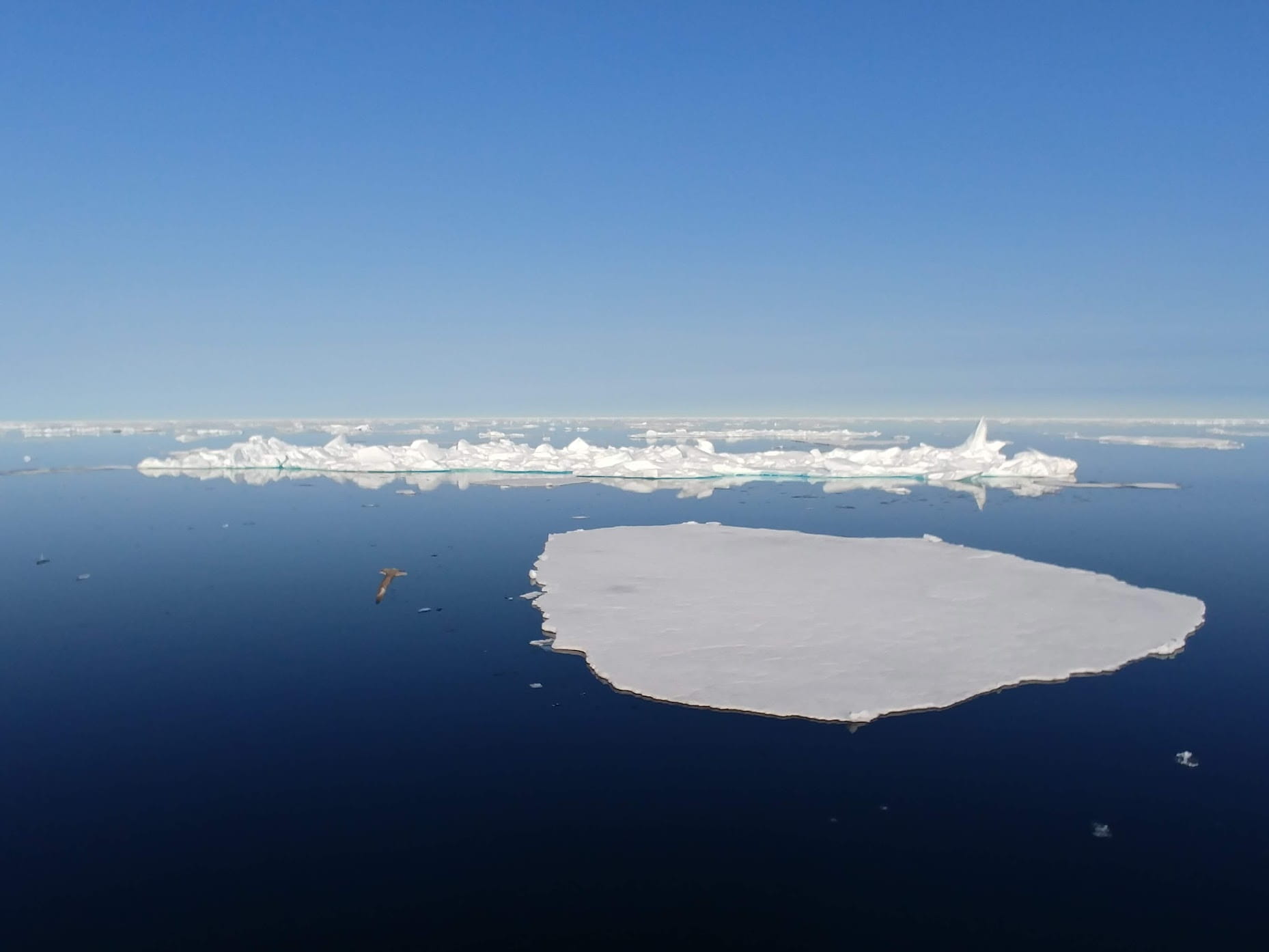
In narratives about the Arctic as a region, decreasing sea ice is seen as a core problem that contributes to multiple cascading hazards. It accelerates climate change through reduced reflectivity (albedo effect) and disrupts global weather patterns. Arctic coastal communities face heightened risks from erosion, which can lead to infrastructure damage and cultural loss. Ecosystems reliant on sea ice are predicted to collapse, affecting interconnected ecological networks, while emerging Arctic shipping routes may increase the potential for geopolitical conflict and environmental damage.
From a local perspective, the lack of sea ice affects how people move around in winter. With less ice, it is harder to travel across fjords—whether by snowmobile, sled dogs, or skis. Some cabins and recreational sites become more difficult to reach. When ice does form, storms lead to ice shoves—piled-up fjord ice along the edges—which further hampers mobility. Increasing wave action from loss of sea ice causes more coastal erosion, and a few houses and cultural remains have been moved away from the shore. Less sea and fjord ice also allows cargo ships to deliver more regularly throughout the year, helping keep the local grocery store better stocked. This also reduces reliance on air transport and makes deliveries more affordable during the winter months.
Geopolitical Issues
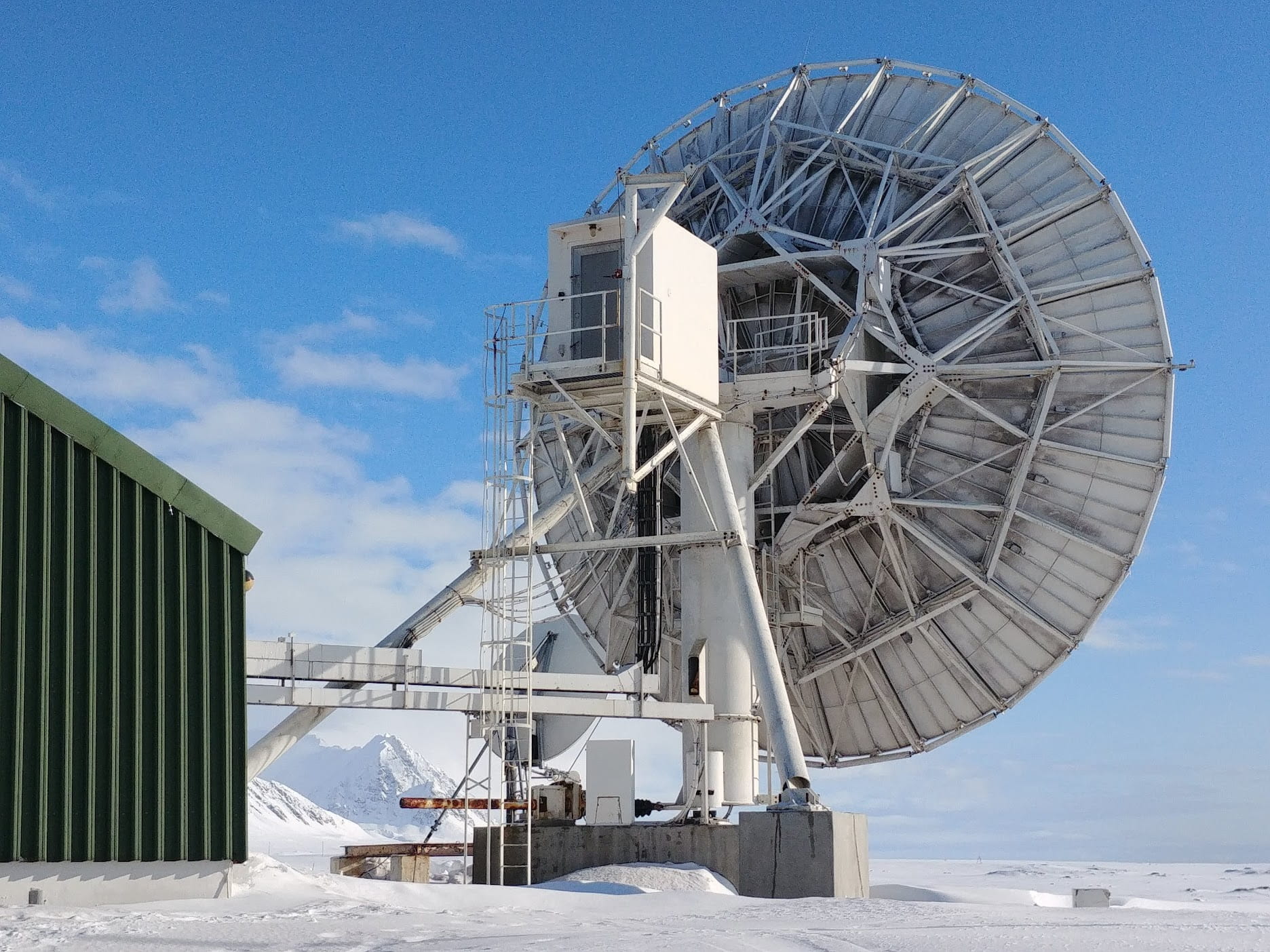
Much of the current discourse about the Arctic focuses on escalating geopolitical tensions and environmental risks as decreasing sea ice opens access to shipping routes and natural resources. This may increase the likelihood of disasters and conflict in a region with limited emergency capacity. Svalbard has become a strategic hotspot within this changing landscape. Governed by the Svalbard Treaty—which affirms Norway’s sovereignty but allows equal commercial access to citizens of signatory nations—the archipelago attracts growing international interest. Within this context, Svalbard is often seen as a place where environmental hazards and geopolitical pressures converge.
Living in Longyearbyen, one quickly becomes aware of political and geopolitical dynamics. The town feels both like a vibrant city—with festivals and cafés—and a remote outpost where key decisions are made elsewhere (generally in Oslo). For Norwegians, Svalbard may be a career stepping stone or a short-term Arctic Adventure. For non-Norwegians, there’s a constant dissonance between the freedom to reinvent one’s life and the lack of political rights or access to healthcare—privileges granted on the mainland. Transiency is high, with 20 percent turnover per year, although there are some long-term residents (Norwegian and non-Norwegian) who hope for a more “normal” town. These perspectives coexist in tension, shaping an everyday awareness of politics, sovereignty, and difference.
Increased Marine Traffic
Increased maritime traffic is viewed as problematic as it, amongst other concerns, may raise the risk of disasters such as collisions, groundings, and oil spills—especially in remote, environmentally sensitive areas like the Arctic where response capabilities are limited. More ships mean greater pollution, noise, and disturbance to marine ecosystems, increasing ecological vulnerability. Harsh weather and ice conditions can make navigation hazardous, leading to potential loss of life and cargo. Increased traffic in Svalbard will strain search and rescue (SAR) operations, emergency response infrastructure, and can escalate geopolitical tensions over control and safety standards.
Awareness of marine traffic in Longyearbyen is primarily about large tourism vessels. Despite efforts to limit the largest cruise ships, some still arrive carrying several thousand passengers—events that draw public attention and are covered in the local newspaper. As in many tourist destinations, reactions to tourism are mixed. In terms of other marine traffic, many are familiar with stories of waiting for the first cargo ship in the spring. However, the opening of the airport in 1975 and the decline of fjord ice mean Longyearbyen is no longer cut off during the polar night, reshaping local rhythms and perceptions of remoteness. Interestingly, even though Longyearbyen is a port town, daily life and identity are not oriented towards the sea.
Search and Rescue (SAR)
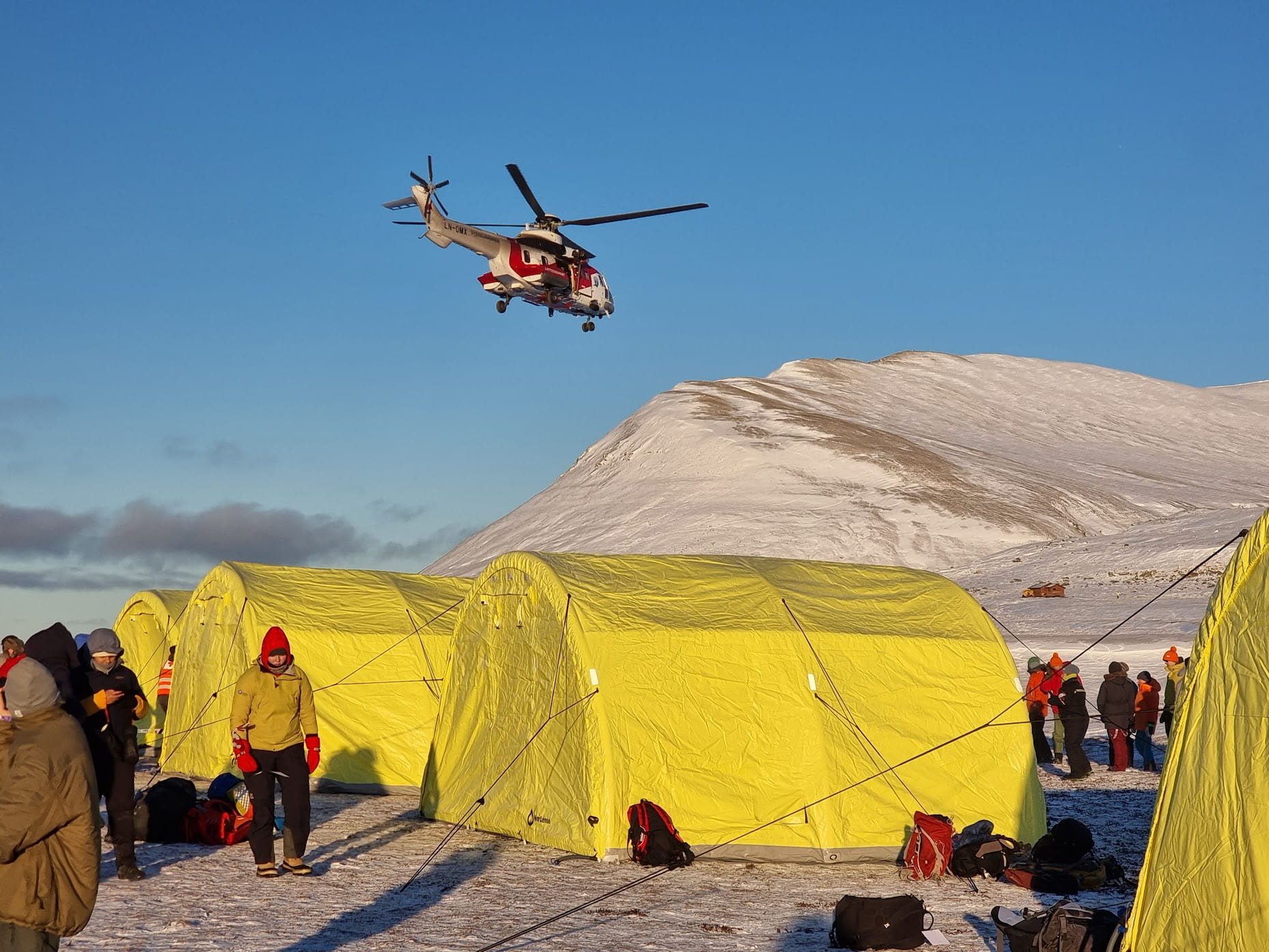
Arctic SAR operations attract considerable professional attention due to their supposedly distinctive operational challenges. Key issues for SAR in the Arctic include extreme weather conditions, limited infrastructure, and vast, remote areas that make timely response difficult. In the polar night, darkness compounds other factors such as cold and ice, increasing the dangers for those affected and responders alike. Communication challenges and the limited availability of specialised vessels and aircraft suited for Arctic conditions also hamper SAR operations. Around Svalbard, these challenges are intensified by growing maritime and human activity, putting additional pressure on already stretched emergency resources.
Locally, one is always aware of the helicopters that fly out, either because it means there is a polar bear or an incident has happened. The local Red Cross is highly specialised, and the training of volunteers is a yearlong process. Although there is a high degree of transiency, there are also some long-term residents who help keep knowledge of terrain and conditions in place. At the same time, the average tenure of a police officer in Longyearbyen, who are also the ones who run the search missions, is roughly one and a half years. This, coupled with many locals being recent arrivals means not everyone knows or understands the local conditions, and people may take unintentional risks, often in difficult conditions. In Longyearbyen, the challenge is to equip people with enough knowledge upon arrival to be better prepared on the ground.
View from the Ground
The four photographs in the second half of this photo essay depict specific sites in or near Longyearbyen that are immediately recognisable to local residents. They reflect elements of the everyday environment that shape place-based knowledge and lived experience. Each image captures locations that form part of the routine visual landscape, representing spaces that residents might pass, use, or observe on a daily basis. Together, they illustrate how familiarity with place emerges not through dramatic events but through repeated, grounded encounters with the local environment.
Avalanches
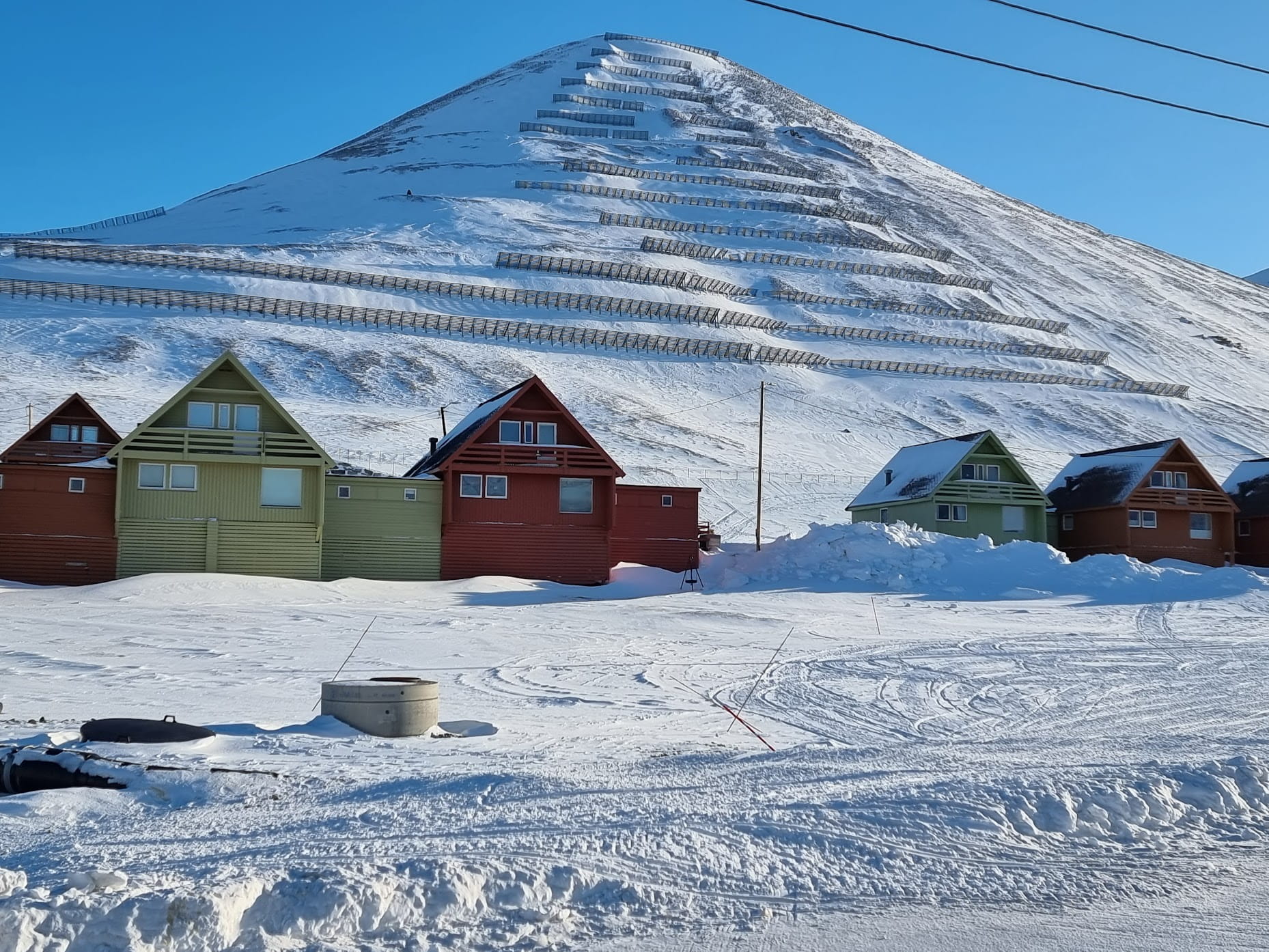
Avalanches are a serious problem in the Arctic due to rapidly changing weather conditions coupled with sometimes poor preparedness as well as difficulties to respond when a disaster occurs. Rising temperatures, rain-on-snow events, increasing precipitation and shifting weather patterns have increased the frequency of avalanches. These events can cause death, damage infrastructure, and isolate communities with limited access to emergency services. While this applies broadly, remote regions especially reinforce the perception that lack of resources can turn small incidents into major disasters. In recent years, avalanches have become an increasingly prominent hazard for both residents and visitors. Rising tourism increases exposure to avalanche-prone areas, while thawing permafrost weakens infrastructure, making the built environment more vulnerable to avalanche impacts. Due to Longyearbyen’s high turnover, many new residents arrive with little or no awareness of avalanche risks or local hazard zones, increasing overall vulnerability.
Living—or even just arriving—in Longyearbyen, you immediately see the avalanche fences that cover Sukkertoppen (see image 4). However, that doesn’t seem to impact how people feel about living in town. How much of that is due to a lack of awareness, and how much to the belief that the area is now safe, is unclear. Those who lived in town in 2015 when an avalanche destroyed 11 houses and killed two people remember the event vividly. Newer arrivals either have not heard about the event or feel disconnected from it. One unintended consequence of the fences, regardless of people’s perception of risk, is the buildup of snow. When it melts in the spring/summer, it brings extra water into the built environment, causing increased damage in these areas.
Infrastructure Issues
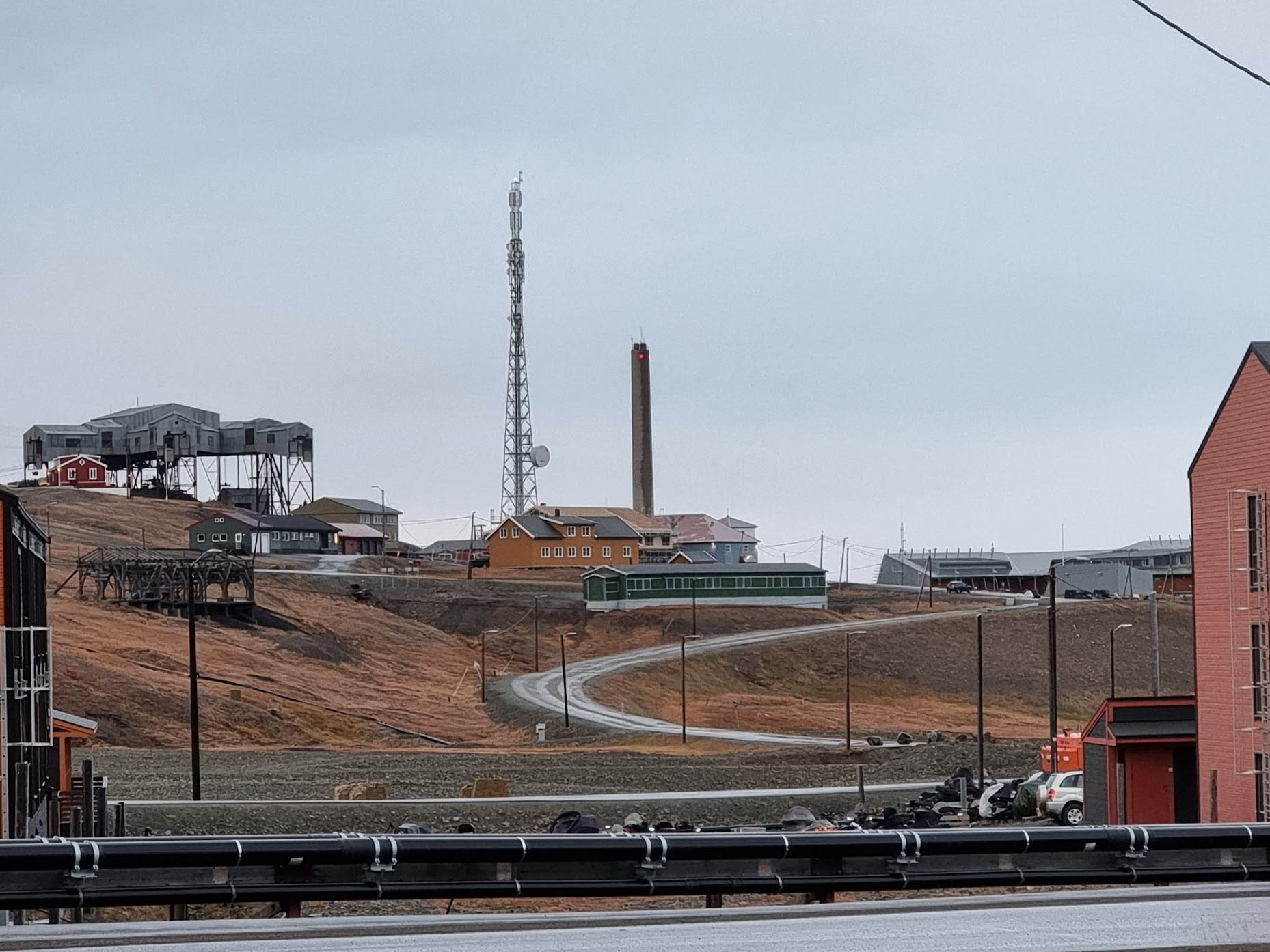
External observers often characterise Arctic infrastructure as significantly problematic due to harsh environmental conditions, permafrost thaw, and limited accessibility. Buildings, roads, and utilities are vulnerable to damage from thawing permafrost (shifting ground), extreme temperatures, and storms. Long distances, minimal transport networks, and lack of resources make repairs slow and costly. Many communities rely on a single road, power line, or supply route, making them highly susceptible to disruption. Emergency services are often limited, and rebuilding takes longer than in more temperate regions. In Svalbard, these challenges are compounded by (relative) isolation, increasing tourism, and a changing climate, putting additional strain on already fragile infrastructure systems.
In Longyearbyen, infrastructure challenges are visible in every part of town. Thawing permafrost causes building foundations—the pillars used to elevate buildings to prevent heat transfer from the structures to the ground—to shift, rot, and develop mould, compromising structural integrity. As mentioned above, snow fences also create unintended consequences—exacerbated by paving practices that now run roads right up to buildings, unlike earlier designs. High workforce turnover means such local knowledge is often lost. Unlike on the mainland, help can’t simply be called in from a neighbouring town, extra supplies for emergencies must be stocked. This requires a fundamentally different living model—one that prioritises contingency planning and long-term risk management. In Svalbard, infrastructure must be built and maintained with future disruptions in mind, not just day-to-day operations.
Supply Chain Interruptions
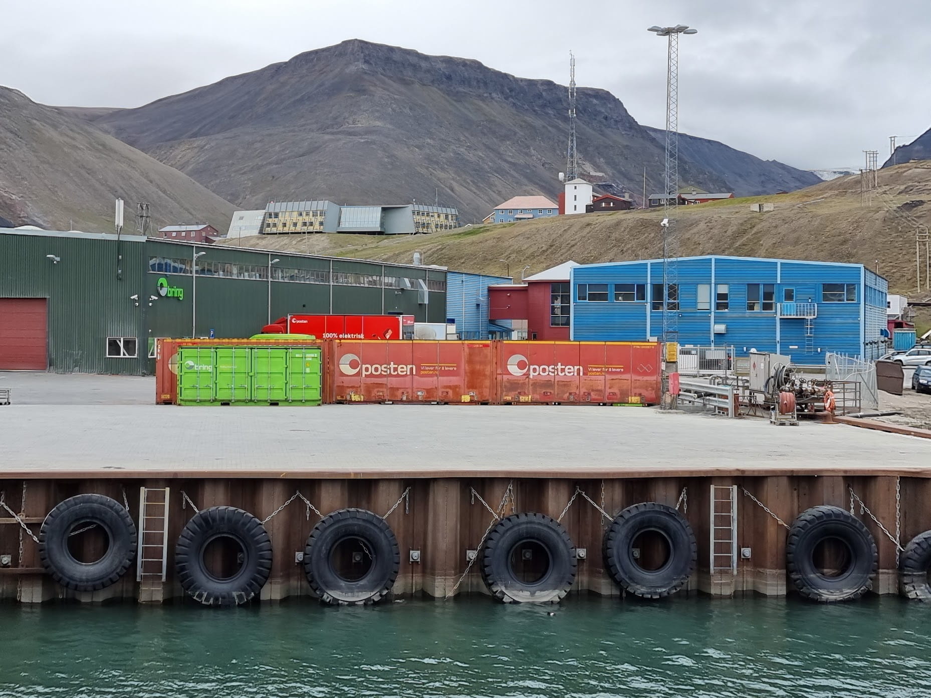
Similarly, supply chain issues are perceived as a major concern in the Arctic due to isolation, extreme weather, and limited transport routes. Most goods must be shipped or flown in, making communities highly dependent on a few seasonal deliveries or costly air transport. Disruptions from storms, ice conditions, or equipment failure can quickly lead to shortages of food, fuel, and medical supplies. In emergency situations, delays in resupply can escalate risks to health and safety. In Svalbard, where nearly all goods arrive by sea or air, any interruption in supply chains has immediate impacts on daily life and emergency preparedness.
From a local perspective, companies involved in supply chain management—whether of essential goods, core commodities, or critical supplies—must operate without nearby alternative suppliers. This raises practical questions about where to store emergency stock and who bears the cost. For example, if three months’ worth of water and rations are needed, who is responsible for providing and maintaining them? As noted under Infrastructure Issues, this differs significantly from the mainland, where neighbouring communities can offer support. In Svalbard, remoteness shapes how businesses function and what kinds of investments they must make, since damaged or delayed cargo shipments can have significant consequences.
Security of Drinking Water
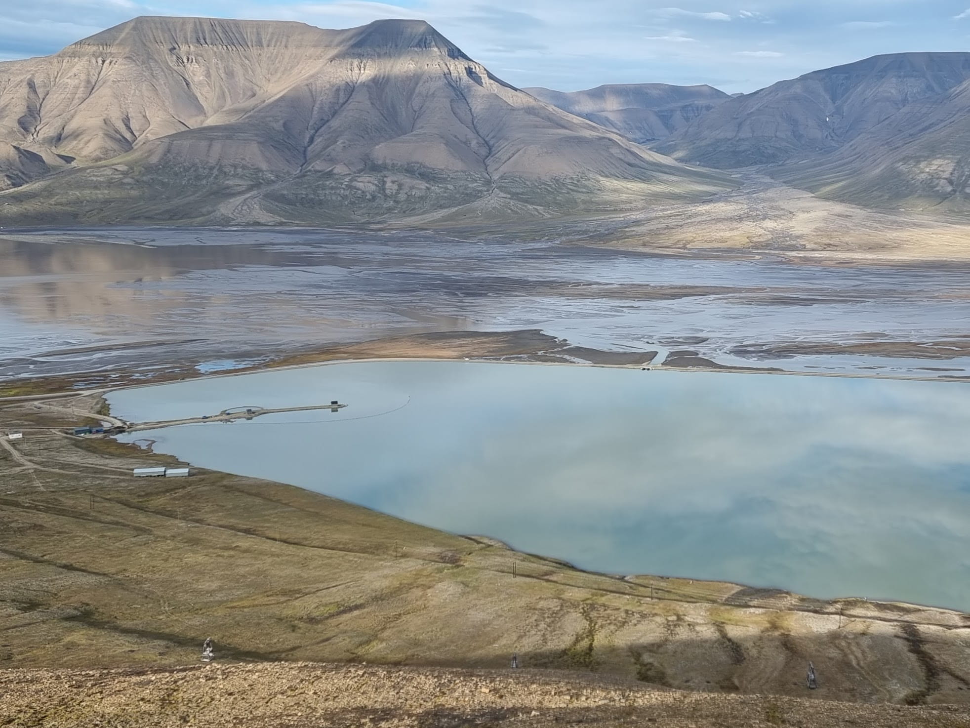
From an outside perspective, access to drinking water in the Arctic is vulnerable due to climate change, limited infrastructure, and environmental sensitivity. Many Arctic communities rely on surface water, snow and glacier melt, or small reservoirs, all of which are affected by shifting precipitation patterns, melting permafrost, and contamination risks. Warming temperatures can reduce water availability or damage pipes and storage systems through ground instability. In remote areas, repairing water infrastructure is costly and slow, making communities susceptible to prolonged disruptions. In Svalbard, drinking water depends on small local reservoirs fed by meltwater, which are increasingly affected by changing seasonal patterns, glacial retreat, and sediment buildup, putting long-term water security at risk.
Until recently, few newcomers to Longyearbyen gave much thought to the local drinking water—likely because it comes from nearby glaciers and is assumed to be naturally pure—even though long-time residents recall when the water often ran brown with silt. Concern grew when authorities closed the swimming pool due to elevated Legionella levels in the water system. Chlorination efforts were unsuccessful, likely hindered by ageing pipes that promote bacterial growth. The resulting change in taste led to increased bottled water purchases, prompting the local store to ration supply. In 2024, further concern emerged over high levels of trace metals—especially manganese—which pose risks to infants. As seen in Image 8, other contamination concerns include increased silt from meltwater, proximity to roads, and limited separation from the fjord, where black and grey wastewater is discharged.
In Conclusion
While this overview does not address all relevant risks—such as energy supply, communications infrastructure, or healthcare systems—it aims to highlight the importance of grounding DRR/R in local perspectives, knowledge, and lived experience. In Svalbard, risks are not only shaped by global forces like climate change or geopolitical tensions (often emphasised in external assessments), but also by the everyday realities of life in a remote, dynamic, and changing environment. Local concerns centre on immediate, embodied threats to safety, mobility, infrastructure, and well-being—revealing how risk is both deeply place-based and interconnected across sectors.
Transiency, a defining feature of life in Longyearbyen, contributes to gaps in risk awareness and weakens the transfer of institutional knowledge—from emergency services to construction practices. At the same time, the fragility of everyday infrastructure—roads, snow fences, water systems, and building foundations—means that slow, creeping risks are just as urgent as sudden ones. In such a remote setting, even a single damaged cargo delivery or pipe failure can trigger cascading disruptions, underscoring the need for redundancy, preparedness, and adaptive planning.
As this visual and narrative exploration has shown, disaster risk in Svalbard emerges not only from dramatic or external forces but also from the entanglement of local infrastructure, social dynamics, and environmental change. Addressing these risks requires governance frameworks that are not only technically robust, but also socially attuned—centred on the lived realities, institutional memory, and adaptive knowledge of those who actually live there. This means developing disaster risk governance that is inclusive, culturally meaningful, and responsive to both global dynamics and local possibilities. It also means developing disaster risk governance that integrates local formal and informal actors and their situated knowledge with external expertise and perspectives, creating a multi-scalar approach that bridges endogenous and exogenous forms of understanding. This approach recognizes that effective governance emerges not from imposing external frameworks, but from creating spaces where local institutional arrangements—from traditional governance structures to community networks—can engage meaningfully with broader scientific, technical, and policy expertise. Such governance acknowledges that communities possess a situated understanding of risk patterns, adaptive strategies, and social dynamics often absent from external assessments, while outside perspectives offer valuable comparative insights and technical capabilities that can complement local knowledge.
The format of this photo essay—juxtaposing globally framed, often abstract framings with grounded, local perspectives that reveal interconnections—has made it possible to explore disaster risk as both materially situated and discursively constructed. By visually and narratively holding these framings together, we see not only where gaps exist, but also where new possibilities for dialogue emerge. The aim has not been to produce a definitive narrative about risk in Svalbard, but to highlight the multiplicity of perspectives necessary for meaningful and context-sensitive DRR/R.
Dina Brode-Roger is a Research Fellow in Cultural Studies whose work focuses on place, environment, and lived experience in the Arctic through place-based and visual methods. Patrizia I . Glick (Duda) is a disaster scientist and practitioner, focusing on disaster risk reduction, especially with respect to sustainable living, biodiversity, and regenerative forestry and agriculture.